
Nor’easter Halts Almost All NYC Travel
Snow is piling up rapidly and powerful winds are making the situation worse for tens of millions in the Northeast as Winter Storm Hernando enters its second day, making travel impossible across much of the heavily populated region.
Power outages continue to spike and entire cities are shut down today, and we have all the latest news and updates for you to track the storm as it intensifies off the East Coast. Stay with us all day and refresh this page frequently so you can see the latest information.
(MORE: What To Expect From Hernando | Maps Tracker Page)
(07:12 a.m. EST) Impressive Snow Rates
From senior meteorologist Jonathan Erdman:
In major snowstorms, it’s not just how much snow falls, but how fast that happens.
We’re seeing snowfall at the rate of 1 inch per hour at New York’s LaGuardia Airport and 2 inches per hour at JFK International Airport right now.
Providence, Rhode Island, picked up almost 14 inches of snow in just six hours.
The National Weather Service office in Upton, Long Island, reported a snowfall rate of 3 inches per hour earlier this morning. Here’s what that looked like:
(06:58 a.m. EST) Thundersnow!!!
It happened again. Reporting live from Plymouth, Massachusetts, The Weather Channel storm tracker Jim Cantore was in the middle of describing the intense conditions when lightning flashed nearby. To watch Cantore’s passionate, excited response, click here.
And if you’ve never experienced near-blizzard conditions, this video is worth a watch:
(06:50 a.m. EST) Tree Damage In King Of Prussia, Pennsylvania
We’re starting to see some ground truth of the damage the winter storm is causing with its heavy, wet snow and strong winds. Check out these pictures of tree damage in King of Prussia, Pennsylvania, which is located northwest of Philadelphia:
(06:41 a.m. EST) Top Wind Gusts This Morning
From meteorologists Jonathan Erdman and Jennifer Gray:
As Winter Storm Hernando continues up the coast, it’s unleashing dangerous, gusty winds. Here are the top wind speeds thus far:
– Wellfleet, Massachusetts: 79 mph
– N. Kingston, Rhode Island: 73 mph
– Nantucket, Massachusetts: 70 mph
(06:27 a.m. EST) Here Comes The Peak Of The Storm
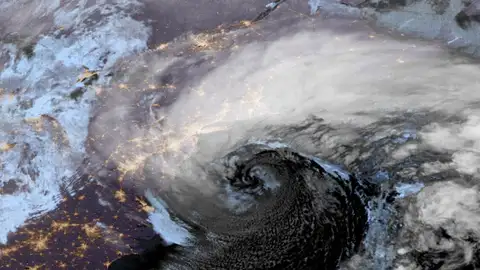
From senior meteorologist Jonathan Erdman:
Having already reached bomb cyclone status, Winter Storm Hernando is nearing its peak intensity. That means the storm is nearing its lowest central pressure off the Northeast seaboard.
While its central pressure is similar to that of a Category 2 hurricane, the storm is cold-core rather than warm-core.
(06:06 a.m. EST) Flight Cancellations Surge Past 10,000
According to FlightAware data, there have been more than 10,000 flights canceled from yesterday through tomorrow in the U.S., virtually all of them in the path of Winter Storm Hernando. That includes more than 5,300 flights today alone.
Another 1,300 flights have already been canceled for tomorrow, so if you have flight plans, it’s best to check (frequently) with your airline, especially if you’ll be flying into or out of the Northeast.
(05:55 a.m. EST) We’re Dealing With ‘Heart-Attack Snow’
From digital meteorologist Caitlin Kaiser:
With temperatures hovering around or just below freezing, this relatively “warmer” air can hold a lot more moisture. This means the snow that is falling is heavier and wetter, which earns its nickname “heart-attack snow” for a reason.
The heavier the snow, the more strain it puts on your cardiovascular system when you’re trying to shovel. So, you’ll want to take extra care before heading out.
Read more on heart-attack snow and how to stay safe while shoveling.
(05:17 a.m. EST) It’s Officially A Bomb Cyclone
With a drop in central pressure of about 40 millibars in 12 hours, this nor’easter has gone above and beyond to meet the criteria of a bomb cyclone. In fact, it achieved the requirement in about nine hours.
To read more about what criteria must be met for a storm to “bomb out,” click here.
(05:00 a.m. EST) Scenes From A Snow-Dusted Times Square


A snowman is seen in Times Square on Feb. 22, 2026, in New York, New York.
(Photo by Noam Galai/Getty Images)


A view of Times Square covered in snow after midnight as the city braces for a blizzard, Feb. 23, 2026, in New York City.
(Photo by Craig T Fruchtman/Getty Images)
(04:39 a.m. EST) Power Outages Spike To More Than 250,000
As expected with a windy nor’easter that’s dumping heavy snow, power outages are rising rapidly. According to PowerOutage.us, these states have the lion’s share of the quarter-million homes and businesses currently in the dark amif frigid conditions:
– New Jersey: 103,000 customers
– Delaware: 68,000
– Maryland: 33,000
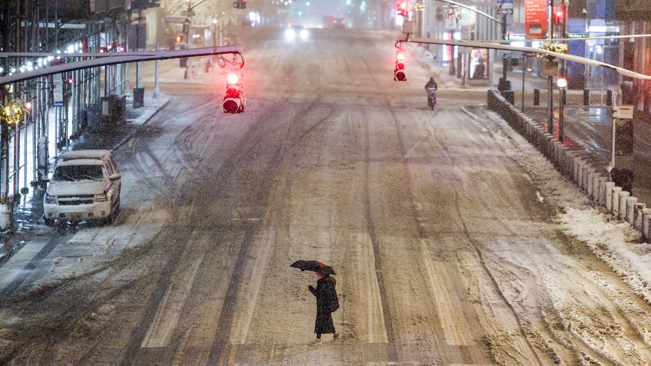
(04:15 a.m. EST) Top Snow Totals To Start The Morning

A woman crosses a street near Manhattan’s Grand Central during a snowfall in New York City on Feb. 22, 2026.
(Photo by CHARLY TRIBALLEAU/AFP via Getty Images)
Winter Storm Hernando really raged overnight. Here are the highest snow totals from this storm, which continues to rapidly escalate, so far:
– Freehold, New Jersey: 17.9 inches
– Mount Holly, New Jersey: 16.2 inches
– South Jersey Regional Airport: 15.3 inches
To see Sunday’s live coverage as it played out, read the full recap here.