Chicago, Detroit, Cleveland On Alert
Severe thunderstorms are once again forecast in parts of the Plains, Midwest and East through Saturday, capping off an active March and kicking off the typically dangerous month of April.
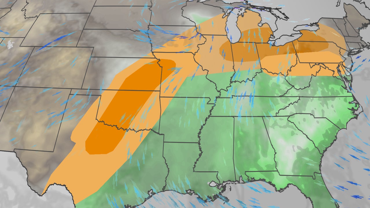
Happening Now
The map below shows where rain and thunderstorms are right now, along with any active watches or warnings.
Forecast
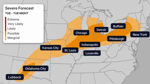
Tuesday
– Main area of concern: Southern Great Lakes, interior Northeast
– Main threats: Large hail, damaging thunderstorm wind gusts, a few tornadoes
– When: Afternoon and evening
Isolated severe thunderstorms are also possible into the central and Southern Plains with hail and strong wind gusts.
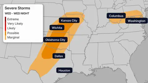
Wednesday
– Main area of concern: Parts of the central, southern Plains from north Texas to western Missouri
– Main threats: Tornadoes (some strong), large hail possibly larger than golf balls, destructive wind gusts possibly up to 75 mph
– When: Late afternoon through the night
All in all, this could be a more active day of severe weather during this week’s stretch.
More isolated severe storms are possible in parts of the Ohio Valley and mid-Atlantic, with hail or strong wind gusts.
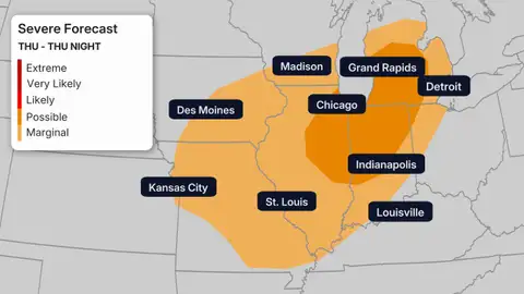
Thursday
– Main area of concern: Parts of the Midwest from Illinois to Michigan and northwest Ohio
– Main threats: Damaging wind gusts and a few tornadoes
– When: Afternoon and evening
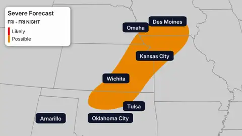
Friday
– Main area of concern: The southern and central Plains, possibly as far north as the Great Lakes and as far east as the mid-Mississippi Valley
– Main threats: Damaging wind gusts, tornadoes, large hail
– When: Afternoon through the night
The map below shows the area where this is most possible several days away.
But, Friday could be a more widespread threat of numerous severe thunderstorms, both as discrete supercells and also as lines of storms.
A threat of at least a few severe thunderstorms could extend into the Easter holiday weekend ahead of the cold front from the Midwest, Northeast and Tennessee Valley Saturday to parts of the East Coast on Easter Sunday.
(MAPS: 7-Day US Rain/Snow Forecast)
Flash Flood Threat, Too
While swaths of the Plains and Midwest are currently in drought, these repeated rounds of thunderstorms could also trigger areas of flash flooding, particularly in areas that have been soaked repeatedly this month.
That includes parts of the Great Lakes, Ohio Valley and Plains.
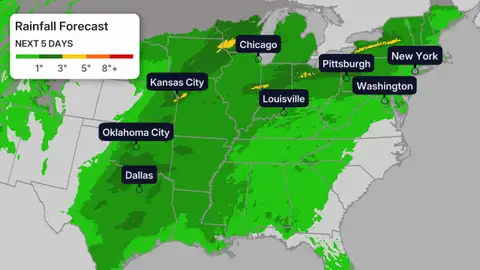
Areas shaded in gray in the map above are expected to see at least some accumulating snow in the period specified.
Be Prepared
There are steps you can take to stay safe in severe weather:
1. Know where to seek safe shelter when severe weather strikes before the storm. If you live in a manufactured home, the safest place is probably either a designated community shelter or the closest building such as a church, industrial building or any building with reinforced concrete.
2. Have multiple ways of receiving official National Weather Service watches and warnings, including from your phone and NOAA weather radio. Make sure your devices are full charged in case you lose power and alerts are turned on to wake you up at night.
3. Seek safe shelter immediately when you receive a severe thunderstorm or tornado warning for your area.
4. Never drive into flood waters. You could be carried away and the road underneath could have been washed away.
(MORE: 14 Severe Weather Tips That Can Save Your Life)
Storm Fatigue
It has been yet another active March for severe weather in the U.S., including parts of the Midwest.
On March 6, four tornadoes struck southern Michigan, including an EF3 in Branch County killing three, an EF2 in Three Rivers and an EF1 tornado that claimed a life in Cass County.
Four days later, a lone supercell spawned 12 tornadoes across northeast Illinois into northwest Indiana, including the EF3 Kankakee, Illinois, tornado, which killed three.
Then on March 15, another 17 tornadoes were confirmed across central and southern Illinois.
NOAA’s Storm Prediction Center has received 196 reports of and confirmed tornadoes in March, almost double the 20-year average of March twisters (104).
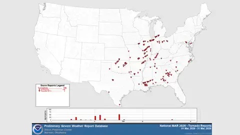
This plot shows both confirmed and reports of tornadoes in March 2026 through early morning, March 31.
(NOAA/NWS/SPC)
Jonathan Erdman is a senior meteorologist at weather.com and has been covering national and international weather since 1996. Extreme and bizarre weather are his favorite topics. Reach out to him on Bluesky, X (formerly Twitter) and Facebook.